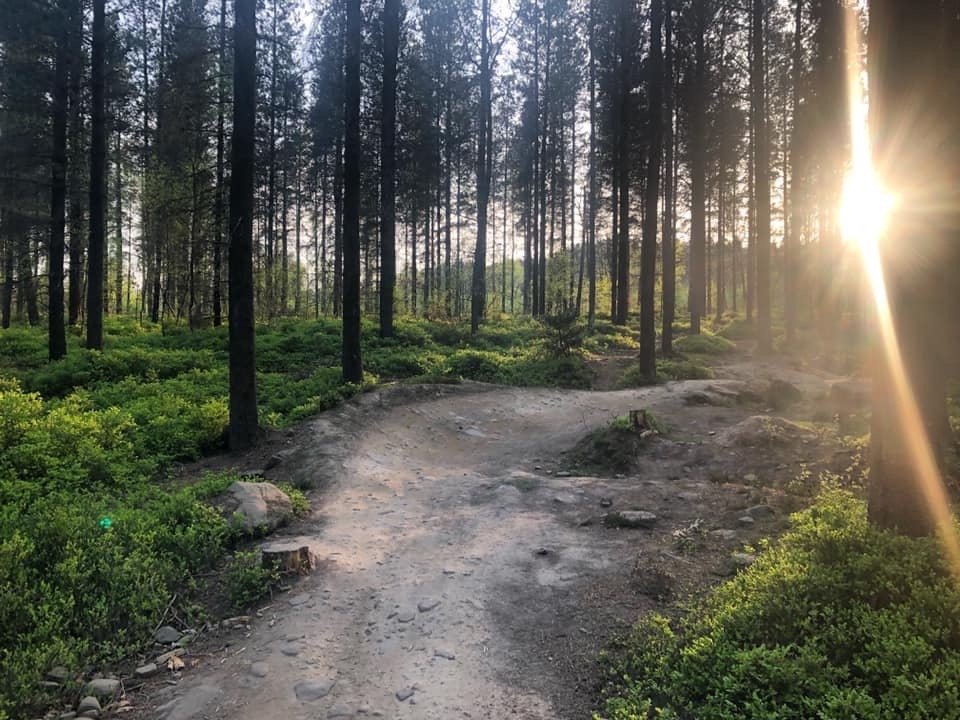
Greno Woods has been providing mountain biking good times for the past 30 years in different guises, from hand cut tracks with wild sketchy jumps, through some quite gnarly north shore and loamy natural runs, to the trails that we have now.
10 years ago, Sheffield and Rotherham, Wildlife Trust bought the woods and in part of the efforts to raise the money (and the profile of the plans) that was needed to buy the woods, we thought a (big) little race would be a good way of contributing to this.
The birth of Peaty’s Steel City DH on a damp cold day in March was the catalyst for further development the woods. Money from the first race went into building the Steel City DH track, funds from the next race went into formalising Pub Run and DH3.
Since the very beginning SCDH has been funding the trails in Greno woods from inception to new lines, refurbs and revamps, with Ride Sheffield managing and maintaining them.
The bikes and the way we ride has changed a lot over the past ten years and we have worked hard to keep the tracks as well running and relevant as possible.
Greno’s trails are some of the most ridden (and loved) across Yorkshire and while they have been built to a great standard by Bike Track, things wear out eventually.
We want the trails to remain a great experience for everyone, we want them to be progressive and to play an important role in the development of riders in the city. But that’s not something that is possible on just the money raised by the race.
Greno Woods Crowdfunder
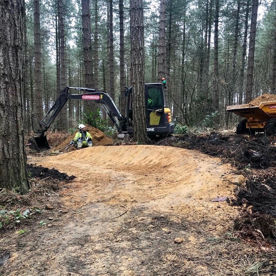
So, here is where we need your help…. We are going to be crowdfunding for the next phase of planned work in Greno, we have some major repairs and redevelopments on Steel City and DH3, but we need your support to get them done!
Want the best berms this side of Whistler Bike Park? Want trail featured that can help progress your riding?
Want trails that run as well in the winter as they do in the summer……?
Well now is the time to contribute. As well as your money raised, SCDH will also be contributing with funds from the race, but the more you can donate the further we can make that money go
Below is a Brief description of the work we plan to do and how much we need to raise to complete each section…. We will have 2 months to raise the funds, with a deadline of the beginning of May and will keep you updated with a weekly totaliser.
Plans and costing
Steel City DH – £8,000
Red trail
The Red trail from the split down will be brought up to the same spec as the rest of the trail.
Build up and reshape all the turns on this section up to the pro jump.
Lift all low-lying areas to above ground level to improve drainage and reduce on maintenance.
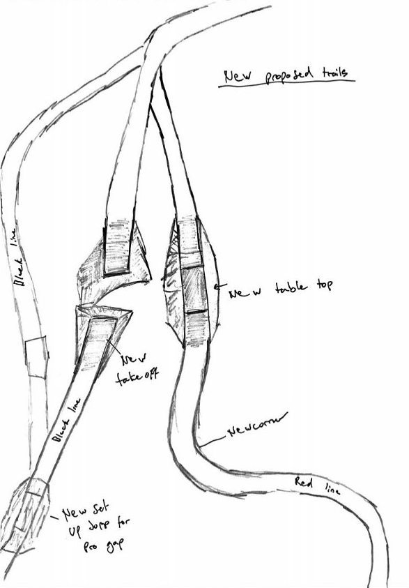
A new corner will be built at the end of this section before the pro jump to separate the Red and Black trails better. The Red trail will now run to the right-hand side of the existing trail where a new tabletop jump will be created parallel to the pro jump.
The new jump will be a rollable tabletop that is similar in shape but shorter than the pro jump to help the progression up to the pro jump.
This jump will land and a new section created to keep riders separated from the pro jump right up until entering the existing corner. This will give riders plenty of time to be able to land and control speed before joining together just before the corner.

Black split
The existing Rollable double will be extended slightly on the landing and angled to suit the new line into the pro jump.
The corner after this will also be changed and built up to improve the line into the pro jump.
A new set up rollable jump will be created out of the turn to gain speed and reduce the need for pedalling into the pro jump.
The existing pro take off will be moved to the left so that it runs in a straight line, this will also open up a safe run off space in between that and the Red trail and will also help for races.
The existing pro landing will stay the same, we will also repair existing black trail to the left of pro jump as a chicken run in normal riding situations.
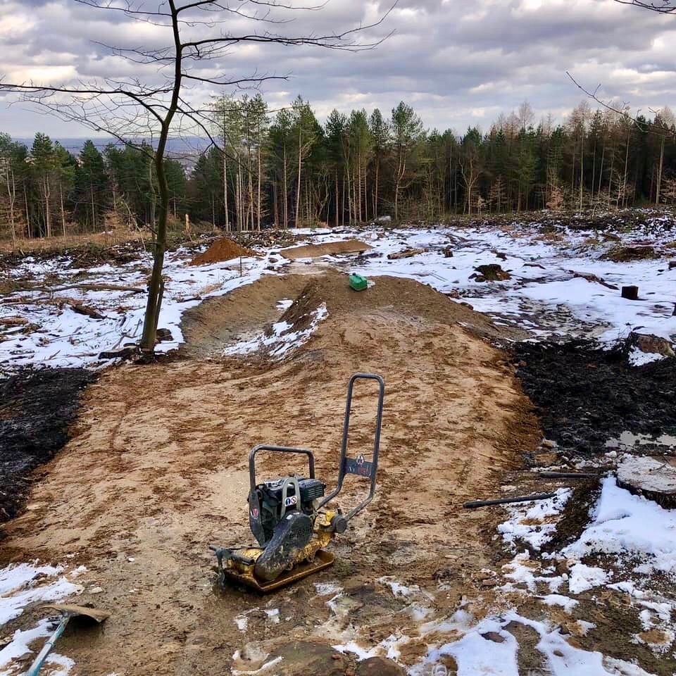
DH3 – £8,000

New rollable features on the top section as better trail qualifiers and to make the first bit more interesting.
The first jump will stay the same but the berm after will be built up and extended to stop riders cutting straight down the open.
The first rock garden will be removed, and a big berm will be made with a feature after it. A new corner will be made before the big rollable double this will help control speed into this feature,
The jump will be resurfaced and all the way into the next berm. The berm after the double will be built up and extended to stop riders needing to brake so much after the jump and also to stop riders going over it and cutting the track.
The first section on the second rock garden will stay but from where it drops, we will take the rest away and a new berm will be made to help maintain riders speed. So, you will have a berm then a straight rock garden then a berm so riders can hop from the rock garden into the berm.
The existing berm before the tabletops will be built up to help maintain speed and to the tabletops. Tabletops will stay same they will just be resurfaced and the landing right into the berm after them. After this point the track will all stay the same just general improvement works and surfacing in areas.
The last big left-hand corner will be redone to repair braking bumps and generally make it better at speed.
Additional Costs – £4000
As well as the direct trail work, there are additional costs in maintaining a safe and fun set of trails, so a little contingency and planning at the start goes a long way
We’d like to include new signage for new trail features and replacing missing/damaged ones.
While we’re getting material, it makes sense to stockpile extra to be used for future volunteer dig days, as borrow pits and material transport are more efficient while done at the same time.
How to Donate
Bank transfer
Direct transfers can be made to the Ride Sheffield account, details as follows;
Account name – Ride Sheffield
Sort Code – 403102
Account number – 91574205
This account is with HSBC.
Paypal
Click the button to donate via Paypal.

Alternatively, send Paypal donations to ridesheffield@gmail.com using “Friends and Family” if possible please! Pop a note in the comments box “Greno 2020” and we’ll be sure to match your donation up.
Commercial donations
We welcome donations from businesses, along with offers for help other than just funding. Perhaps you can provide food or tooling for a dig day or can offer prizes for us to run a prize draw for people who’ve donated.
Please contact ridesheffield@gmail.com to discuss any idea you or your company might have.
Looking After Greno
Beyond the Crowdfunder one of the best ways to keep the trails running sweetly well into the future is to get involved in the upkeep of the trails as part of a Ride Sheffield Trail Crew. We would like a dedicated trail crew for Greno and will be make sure that you are fully trained to carry out the work, so if that interests you, please get in touch.
But for now, donate, spread the word and make Greno great again!